Multivista construction drone services are ideal for:
Site Planning and Progress Tracking
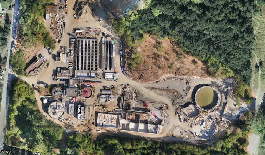
Conducting Aerial Site Surveys
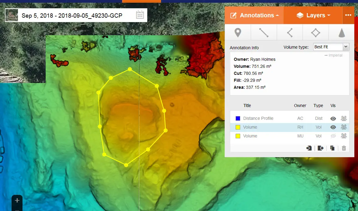
Tracking Equipment and Measuring Volume
QA/QC and Inspection
Site Mapping
Creating Breathtaking Marketing Deliverables
All UAV/Drone-captured photos, videos, and panoramas are uploaded into our intuitive cloud-based platform for anytime access by an unlimited number of project team members.
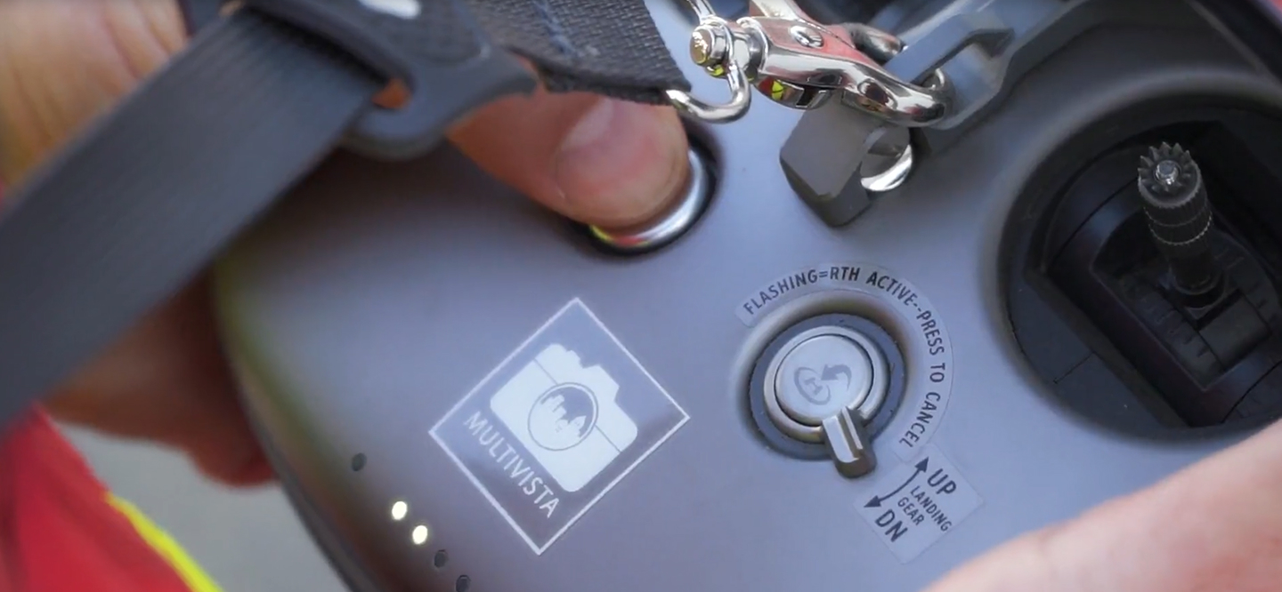
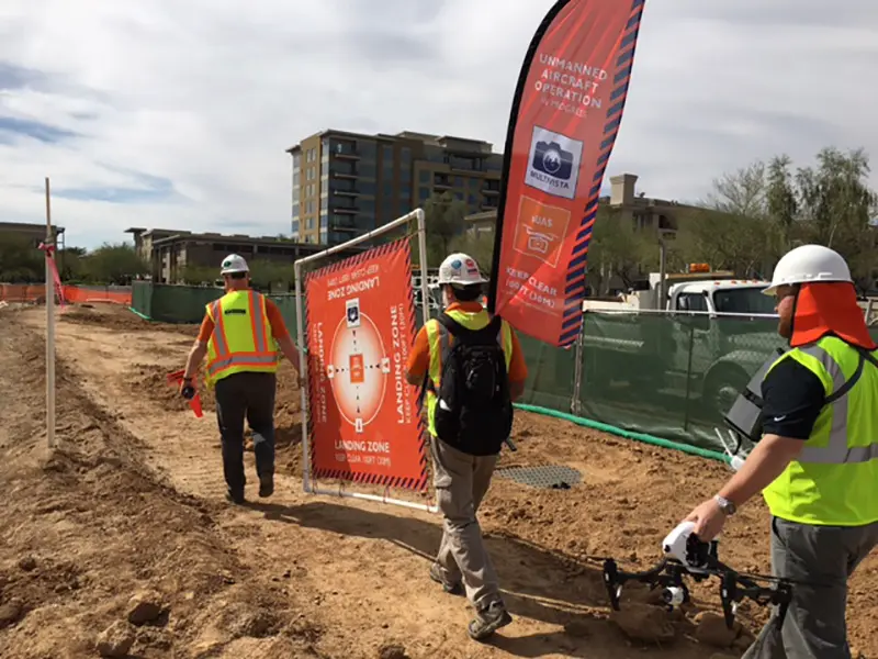
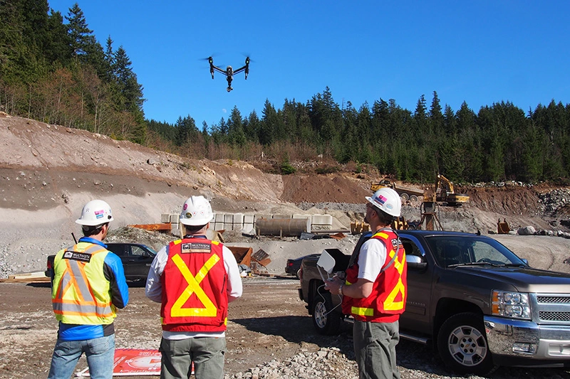
Every Multivista UAV/drone is operated by a certified construction UAV/drone pilot and Visual Observer (VO) team, each expertly trained in construction-specific UAV data capture techniques. We file all necessary waivers, comply with all aviation regulations, and adhere to the necessary insurance requirements to ensure that each flight is safe and compliant.
Cutting-Edge UAV/Drone Mapping Technology
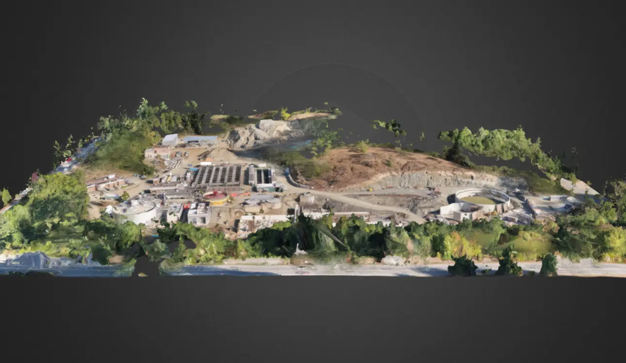
Multivista offers UAV/Drone mapping services powered by DroneDeploy, the global leader in drone software. With an interactive, 3D UAV map of your site, you gain the unprecedented ability to instantly view, measure, and manage your project.
Uav/drone Photography, Video, And Site Maps Capture Every Angle
Multivista offers a full suite of professional construction drone and UAV services tailored to vertical or horizontal construction projects of any size. Learn how professional construction UAV/drones deliver the actionable project intelligence your team needs.
How it works
You schedule shoots
Choose the capture cadence that fits your project: weekly, biweekly, or milestone based. The frequency is up to you.
We capture your site
Our certified and insured UAV/drone pilots come to your site to safely document your jobsite as often as needed.
Photos mapped to plans
Access, annotate, and share your photos, ortho images, point clouds, and mesh models at any time via cloud based software platform.
Leverage intelligence
Use aerial scans and photos to accelerate timelines, reduce rework, adjust schedules, track equipment, and more.
Repeat as needed
Our team is there for you from before groundbreak to handover.
Create useful deliverables
Deliver stunning project photos and videos to facility owners, marketing teams, or future tenants and owners.
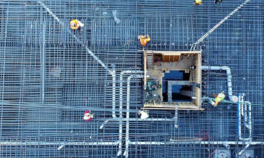
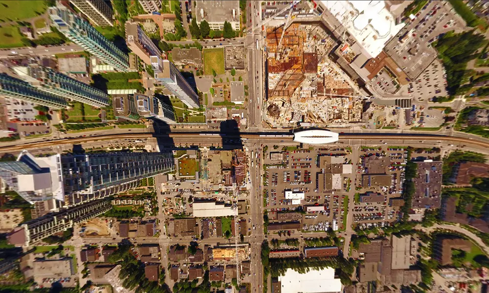
Construction Uav/drones Capture Project Clarity At Every Elevation
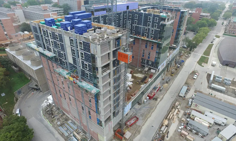
Construction drones and UAV technologies deliver the actionable project intelligence you need. Multivista’s construction UAV/drone services capture multiple perspectives at varying elevations of your project. Our UAVs fly 10x closer than standard aerial photography. Lets us capture your project straight down, at oblique angles, through project flyovers, or sweeping panorama.
We've Got You Covered
Full-service, client-directed construction UAV/Drone shoots
No expensive equipment purchases or maintenance necessary
No leased equipment or expensive subscriptions
No automated flight path limitations
No costly training, certifications, or aviation insurance
No do-it-yourself regulatory adherence
No data output management needed
“For us, it’s a no-brainer to have an unbiased independent party creating a comprehensive photographic record of construction progress.”
Kyle McClelland
Redevelopment Project Director
Bedfordshire Hospitals NHS Foundation Trust, UK
“I would recommend this tool on every job and to every owner…”
Matthew Graziano
Superintendent
Skanska, USA
“Thoroughly documenting the rough conditions of a finished space to show compliance allows us to give our client peace of mind and adhere to the demands of the project schedule. Multivista has been instrumental in this way by capturing the in-wall and above-ceiling in an organized fashion.”
Robert Romanoff
Field Engineer
Turner Construction Company
“I would recommend Multivista to any PM, contractor or owner seeking to reduce project risks and save time and money on their construction projects.”
Dave Fox
Project Manager
Jacob's Engineering
“I have had the pleasure of using Multivista’s services on two projects now and the experience just keeps getting better. Multivista’s photo documentation services provide me all of the as-built information and protection I need in a professional platform without tying up a member of my staff. I fully intend to use them on every project in the future.”
Brad Adams
Project Superintendent
Flintco Residential
“Multivista’s platform is easy to use and allows us to solve issues quickly and efficiently. It provides you with the peace of mind to go through your process and get your building done. We can’t recommend Multivista enough.”