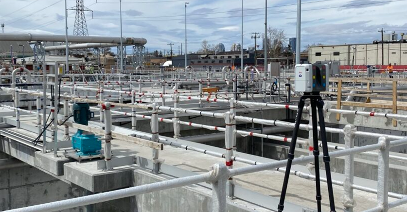
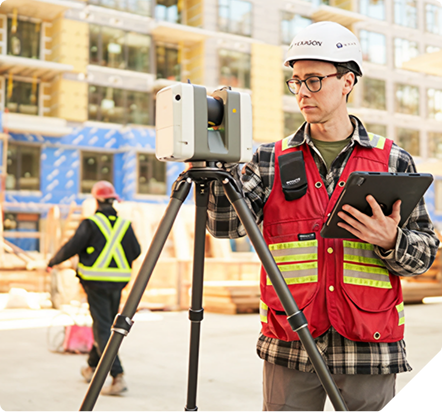
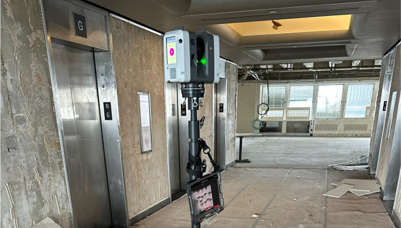
Utilizing the latest in 3D laser scanning technology from our sister company Leica Geosystems, our 3D scanning service is delivered by local teams, available nationwide and around the globe.
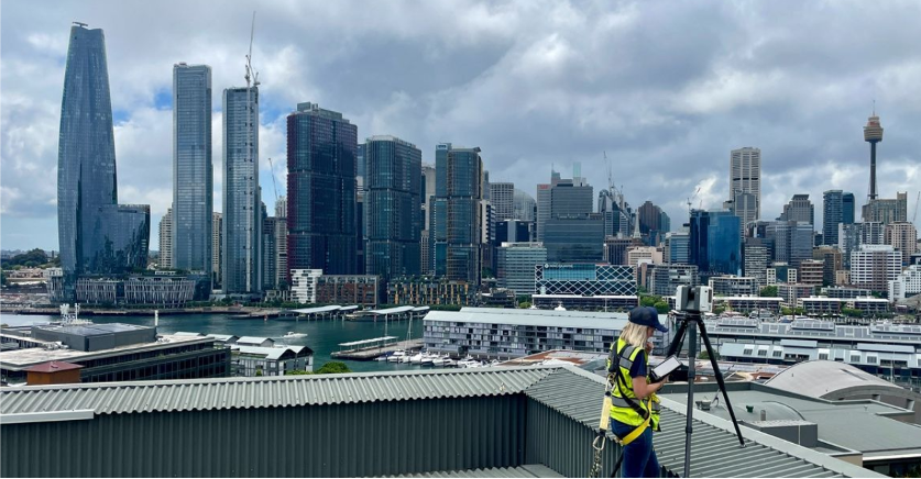
With +150 highly trained reality capture field specialists, Multivista teams can support your projects whether large or small for a variety of purposes. We can provide point cloud data for your renovation project, scan during construction to verify and record as-built conditions or capture existing assets for ongoing facility management and maintenance.
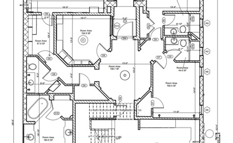
Leveraging the accuracy of 3D laser scanning, our scan to services team turns point cloud data into 2D as-built CAD drawings. Based on your requirements Multivista can deliver architectural drawings in Autodesk AutoCAD DWG and DXF format.
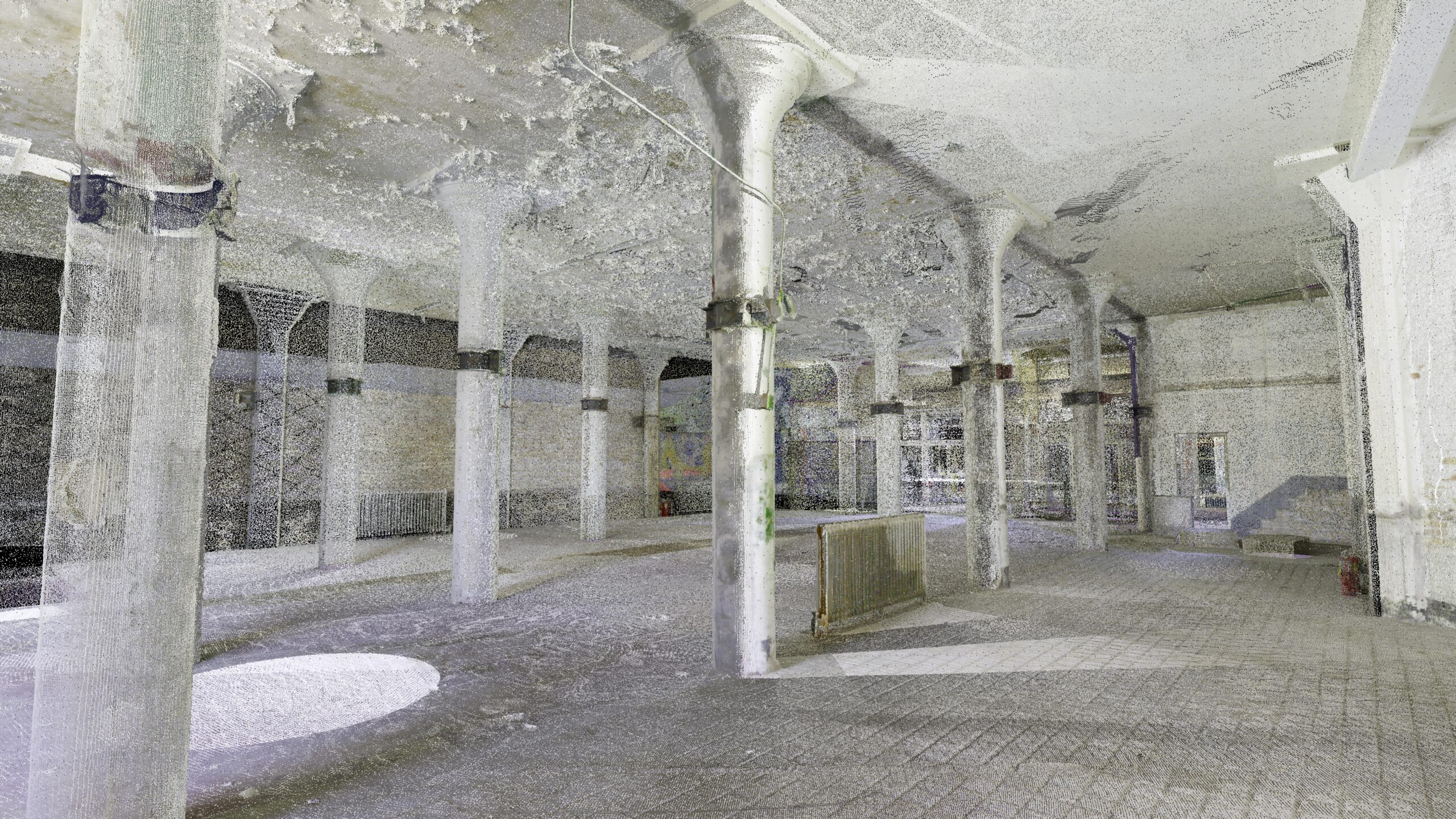
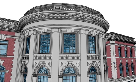
We transform your 3D point cloud data into highly accurate 3D Building Information Models (BIM). As-built models are extracted from the captured scan data by our team or qualified Architects and Engineers.
– Architectural Scan to BIM
– Architectural Base Models
– Architectural Add-on packages
– Site Add-on packages
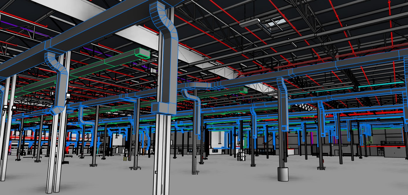
– Mechanical, Electrical and Plumbing (MEP) Scan to BIM
– Mechanical Add-on packages
– Electrical Add-on packages
– Plumbing Add-on packages
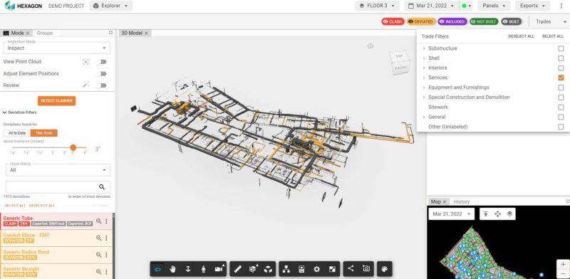
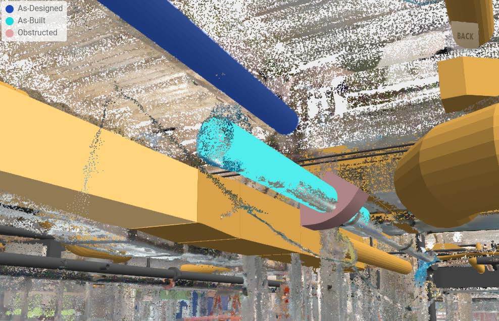
Catch costly errors early with Hexagon’s Deviation Analysis. Automatically spot discrepancies between BIM design and reality to avoid rework. With Hexagon’s Deviation Analysis you can share quality insights, ensure accurate as-built models, and keep all stakeholders aligned on your project’s progress.
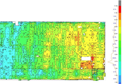
Uneven and unlevel floors cause costly problems during construction. Multivista uses laser scan data and the latest analysis software to generate a PDF heatmap report that visualizes the deformation and contours of the floors surface, to give you visibility of potential problems.


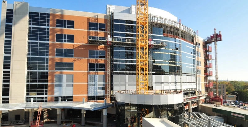
Hospitals are complex facilities with critical infrastructure and a high density of MEP systems. The accurate documentation and digitization of these complex structures is critical to the success of any construction project or for ongoing facility management system.
Laser scanning provides a fast and non-intrusive method to capture healthcare facilities in precise detail allowing for the creation of accurate CAD drawings or 3D BIM models.
Leverage these deliverables to base design on real-world digital information, avoid costly mistakes from outdated plans or models.
Traditional methods for measuring buildings are time consuming and prone to error. Complex facilities like schools and universities often provide an impossible challenge to capture without the use of a modern 3D laser scanner.
Multivista can quickly scan these spaces in 3D and deliver a complete 3D picture, saving your team hours of time spent on site with measuring tape and clipboard.
The point cloud created by 3D laser scanning can also be linked to a georeferenced coordinate system via survey control, making it simple to visualize how each building on campus relates to the others.
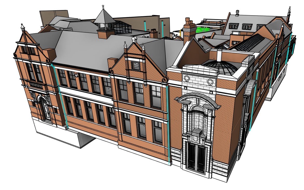
Precise 3D footprints are invaluable for both new commercial development and changes to existing structures. Often outdated plans cause costly mistakes which result in downstream project delays. 3D laser scans capture the true as-built situation on site and can be used to assess the impact of costly work before it’s performed, allowing you to propose multiple options for each property.
Trust Multivista to transform your commercial properties into information-rich and easily accessible digital assets with our 3D data capture services.
Whether a single-family home or a twenty-story tower block the need for accurate as-built documentation to start or finish your project is critical. 3D scanning captures a precise 3D dataset of your projects real-world situation which can be shared to stakeholders throughout the globe via Multivista’s online platform.
Our fully immersive 3D walkthrough connects people to their projects allowing our clients to virtually visit site without leaving their office. Collaborate with colleagues using the high-resolution measurable imagery or download the 2D CAD or 3D BIM model deliverables created by our scan to services teams.
Our 3D reality capture professionals collect fast, accurate and dense geospatial data for industrial projects, avoiding potential hazards and limiting disruption to sites and work areas. Our 3D specialists have scanned:
Once captured our scan to services team will extract accurate 3D models of all the MEP systems and elements visible on site.